The springs on Mist Mountain have gained popularity on the internet for the novelty of natural hot springs accessible to hikers. The trail brings hikers over a pass before skirting around Mist Mountain to the springs. But is the trail really worth the hype? Continue reading to decide for yourself.

Mist Mountain Springs Hike Summary
- Difficulty: Hard
- Distance: 8 km
- Elevation: 555 metres
- Trail type: Out-and-back
- Time: 4-5 hours
- Trailhead: Mist Mountain Trailhead
Finding Mist Mountain Springs Trail
The hike is just off Highway 40, in the south end of Kananaskis. The drive is about 2 hours from Calgary, so be sure to include that in your timeline. This is an undesignated route and there is no official sign for the trailhead. The AllTrails app provides the correct location or Google Maps will get you close.
It is close to the Picklejar Lakes Trailhead; you’ll pass Picklejar about 6 minutes before reaching Mist Mountain if arriving from the south. Although there is no official parking lot and you will need to park on the shoulder, it is still necessary to purchase a Kananaskis Conservation Pass for the trip.
Look for flagging tape to note the beginning of the hike. The trail begins right off the highway and is not particularly well-marked, but once into the trees the trail is clear and established. This is a 6.4 km trail, out-and-back (12.8 km total), with 555 m of elevation. Give yourself plenty of time if you want to relax at the springs.

Hiking to Mist Mountain Hot Springs
We began the hike at noon, after getting slightly lost on the drive due to construction and road closures. We completed this hike at the beginning of August, before the bear closures. Always check trail reports and reviews before heading into the backcountry, as closures due to animals do occur, and can be lifted or placed at any time.
It was a beautifully warm day and sunny the entire hike. We reached the top of the pass at about 1:30 and stopped to eat our lunch. However, after reaching the top of the pass the wind became quite significant.
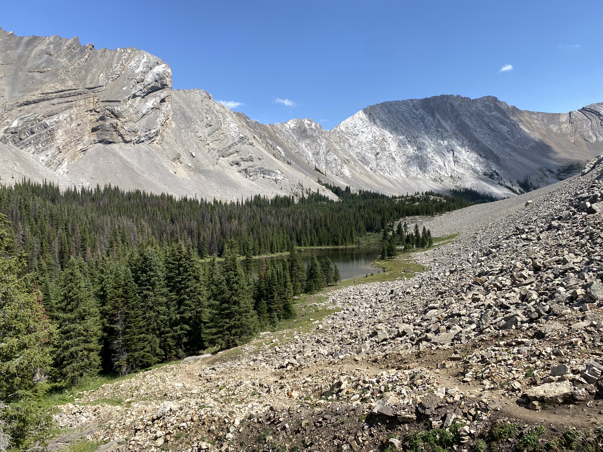
The terrain after the pass becomes less stable; a scree slope that can slip out from under foot if you stray from the established trail. I would recommend bringing poles to offer extra stability. We found them useful for this section of the hike. Keep an eye out along this section of the trail as we found a number of fossils embedded in the rocks here!

The scree slope curves around and crosses a creek. There are a number of paths along the slope here, we found that the lowest trail was the most direct to the springs. The path to Mist Mountain Summit branches off from the trail here. If you wish to continue to the peak, you will stay on the left side of the slope and head upwards, away from the creek. If you wish to visit the springs, continue following the trail that descends slightly along the side of the mountain.
The springs are visible once you exit the patch of nearby trees. Descend along the trees, then cut across following the path. You can cut straight across the rocks after emerging from the trees, however we found, after taking that route, that the return trip along the lower section was far easier to manage.
Swimming in the Natural Hot Springs
When we arrived at the springs, we were greeted by several groups. While it seemed as though our time in the water would be limited, if at all, based on the number of other hikers present, there was a system of rotation that allowed everyone to enjoy both of the two small pools. When you visit, be courteous of other hikers and share the space.
Definitely bring a swimsuit for this hike! You want to enjoy the springs you travelled all this way for. While coverage is minimal for changing (there is a sparse bush nearby), the experience of being in the springs is not to be missed.
We had a snack before changing, then were given our chance in the pools. The water was very clear, and a pleasant warm temperature. These natural hot springs were not hot by any means, but very nice in comparison to the glacial lakes and streams otherwise found in the mountains. There is some slippery algae along the rocks so watch your step!

The Return Hike
We began the hike back around 3:15 pm. We took a few detours, and ultimately made it back down by 6 pm. I will admit, I am not a quick hiker coming downhill, as my knees are not fans of the descent.
I would consider this to be an intermediate hike, certainly doable for most groups, but with significant elevation to the pass, and some more technical terrain beyond it.
Important Information about Mist Mountain
The Mist Mountain Springs Trail is only open from June to December, as the highway is closed during the winter months. It is not recommended to hike Mist Mountain after October, however, as the potential ice and snow makes the hike both more difficult and less enjoyable – not that winter hiking isn’t fun! I just wouldn’t recommend this trail for off-season hiking.